
Korkykos
Korkykos
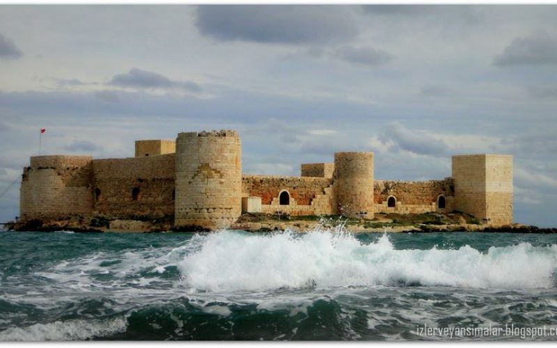
Korkykos, It is 60 kilometers from Mersin. Turkey has many ‘girls castle’ Korkykos is one of. Korkykos city 3.5 km west of Elaeussa. First mentioned as taken by Antiochos III from Ptolemaic control in 197 B.C., it minted autonomous coinage in the 1st c. B.C. and shared the fate of Elaeussa under the Romans until ca. A.D. 72. It was noted as a port in Roman times, and was extremely important in the Byzantine and mediaeval periods. Taken by the Turks in 1448, it slowly declined in importance as a port until the 19th c. when it was practically deserted. Its ancient name was never lost.
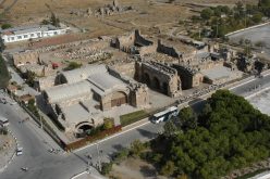
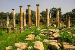
The scanty remains are apparently confined to two small peninsulas ca. 425 m apart and a narrow gentle slope inland from them. On the east peninsula and inland are some undescribed remains of buildings. The west peninsula is filled by a large Armenian castle and has a mole extending from it, protecting a small harbor to the west. Incorporated in the south east wall of the castle is a well-preserved single-arched Roman gateway, which led from the quay probably to a market, which may lie under the castle. East of the castle about 100 m are the foundations of two buildings, perhaps temples, with column fragments and wall blocks lying around. A line of bases, perhaps from a colonnaded street or stoa, is oriented nort west – south east, about 100 m north east of the temples .
Inland from the city, along the ancient road from Elaeussa, and along the steep slope a little way inland is the ancient necropolis, clusters of sarcophagi and rock cut chambers, numerous inscriptions, and one conspicuous relief of a warrior with sword and spear. One grave chamber constructed of polygonal masonry may be Hellenistic or Roman; the rest of the necropolis is of the Roman and Christian periods.
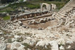
The Byzantine city wall can be traced in an arc from the shore 1.25 km east of the castle to the slope 375 m north west of the castle. Just south of the modern road to the east of the wall can be seen the ancient water course leading from Elaeussa and Lamus. Inside the wall and out are a number of churches, some very well preserved, of the 5th and 6th c., and one of the Armenian period. About 0.75 km south of the mainland castle and close to shore is a small island (ancient Krambus) with a well preserved Armenian castle of the 13th c., built perhaps over a Byzantine predecessor.
About 3 km from Korkykos on an ancient road to Kambazli are two watch towers and behind them a cluster of buildings within a wall of polygonal masonry, just above the sheer wall of the Seytan Deresi (Verev D. or Karyagdi D.) gorge. The towers and fort may be part of a Hellenistic Olban defense system, or a retreat for Korykians. Below the fort are several rock cut memorial reliefs of the Roman period and an inscription probably of the 3d c. B.C.
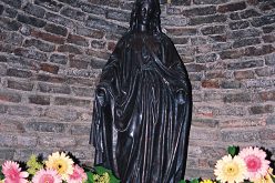
Five km west of Korkykos, 1 km inland, is the Korykian Cave, a natural limestone pit, opening out as a cave. Above it is a Temple of Zeus, perhaps ainphipro style, with a peribolos wall of elegant polygonal masonry. An inscription on the temple gives a list of priests, the first name apparently of the late 3d or early 2d c. B.C. A myth concerning Zeus and Typhon was localized at the cave; the original Hittite or Luvian myth and cult may have been placed here as early as the 2d millennium B.C. In the mouth of the cave at the bottom is a well preserved chapel to the Virgin, perhaps of the 4th c. Less than a kilometer north of the cave another Temple of Zeus was reported.
Related Articles
Write a Comment
Only registered users can comment.
