


Edirne
Edirne
Edirne (still known sometimes by its old name Adrianople) is a city in Eastern Thrace, the northwestern part of Turkey, close to the borders with Greece and Bulgaria. Edirne served as the capital city of the Ottoman Empire from 1365 to 1453, before Constantinople (Istanbul) became the empire’s new capital. Edirne is a living city – museum with its mosques, religious complexes, bridges, old bazaar places, caravanserais and palaces.
As it was the capital city of the Ottoman Empire 100 years ago, there are numerous historical and architectural important structures in the province. The area around Edirne, thanks to its strategic position on the major routes towards Istanbul, Bosphorus, and onward to Asia, is one of the spots on earth that was heavily fought for—it has been site of no fewer 16 major battles and sieges since the days of Ancient Greeks. Edirne’s former name is Adrianople (Hadrianoupolis), i.e. “City of Hadrianus”, named after the Roman emperor who founded the city on the site of Thracian village of Uskudama. Then in 14th century, Ottomans captured the city and made it their capital, a situation which lasted until the Fall of Constantinople. Even after the dynasty moved to Constantinople in mid 15th century, Edirne was one of, if not the most, important centres of European part of the Ottoman Empire, which once extended all the way well into Hungary, and still was some sort of semi-capital of the empire, with some sultans even favouring the city over Istanbul and mumbling (to no avail) about returning the throne back to the city. Between 1700 and 1750, Edirne was the fourth biggest city in Europe, with an estimated population of about 350,000 people. However things dramatically changed with the beginning of 19th century and the city suffered heavy depopulation in the context of Russo-Turkish wars of 1829 and 1878 when Russians occupied all the way to western suburbs of Istanbul, Balkan Wars of late 19th/early 20th century, the loss of much of the hinterland and even outer suburbs to north and west when international borders non-existant before (when all was part of Ottoman Empire) were created close to the city in 1910s and 20s, and the Second World War when Nazi armies were only miles away from the city, just on the opposite banks of the rivers and most of the population was evacuated into interior Turkey. Some of whom could not flee died of following famine during this period. This depopulation trend slowly but constantly continued until very recently and the city is now home to barely 140,000 people. Although it is quite a lively city, especially compared to other Turkish cities of this size, however all you see today is just a fraction of its former glory
Places to Visit ;
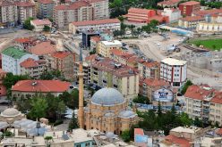
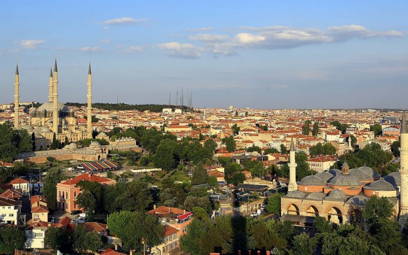
The sights in Edirne can be roughly grouped into those that are in downtown, those in northwestern neighbourhoods (Sarayiçi, and Yeni imaret) across the Tunca River, and those in southwestern neighbourhood (Karaağaç) across the Tunca and the Meric Rivers. A good number of medieval bridges span these rivers. Downtown Main sights in downtown are quite close to the main square and to each other, and can be (hastily) done in half a day. Selimiye Mosque (Selimiye Camii), (at the central square). That mosque which dominates the skyline of the city, built on a slightly higher hill than its surroundings, although a play on dimensions makes the exterior sight of the building smaller as you get closer to it. A grandiose piece of art by Sinan, the Ottoman architect of 16th century, Selimiye is usually considered the zenith of Ottoman architecture and has been listed as a World Heritage site by UNESCO in 2011. Sinan himself considered this building as his best work. The dome of the building, which hangs high over main hall, encloses a huge space which gives the place an expansive atmosphere, had the largest diameter (31.28 mt) of all domes in the world for several centuries. And its minarets (towers) are the second highest minarets (70.89 mt) in whole world, surpassed only by Qutb Minar (72.50 mt) in Delhi, India. The mosque has 999 windows in total, which according to its architect Sinan, symbolize the perfectness of God. The dome and interior walls are decorated with calligraphy and geometrical designs, most of which are painted in hues of pink and blue. If you have admired Blue Mosque (Sultanahmet Mosque) of Istanbul, you’ll sure adore this one, since Blue Mosque is quite a copy of Selimiye. The upside down tulips, which are some sort of symbol of Edirne have their origin in a tulip illustration engraved on a marble in the fountain right under the central dome of Selimiye. It is believed to symbolize the landlord of the tulip garden on which the mosque was built, who was said to be reluctant to give over his garden. There is a small museum in the courtyard with no admossion fee. Very interesting knick-knacks can be seen there. Old Mosque (Eski Cami), (at the central square, across the street from Selimiye). The smallest—and the oldest—one of three nearby, imperial mosques in downtown Edirne, it’s known for its calligraphic inscriptions on its interior walls with a small central dome atop. Üç Şerefeli Mosque (Üç Şerefeli Cami), (just north of Old Mosque, close to Selimiye). This mosque is easily recognizable, having four distinctive minarets that all have very different designs, uncommon during the 15th century, one of which has three balconies, giving it its name which literally means “three balconied”. Long undergoing restoration, interior of the mosque, which features a colorfully decorated central dome, smaller surrounding domes of varying sizes each featuring a different colour pattern, and very stately columns supporting them, has recently been re-opened to visits. The overall experience of this colourful mosque is perhaps best summarized as “joyful”. Macedonian Tower (Makedonya Kulesi), (just across the side street from Üç Şerefeli). The sole still intact tower of Edirne’s city walls, named as such perhaps because it roughly watches the direction of Macedonia, or because of the former definition of “Macedonia” which extends all the way to Edirne. A round and robust tower, not unlike Thessaloniki’s White Tower except its colour, and next to it is the last visible section of city walls, now surrounded by a nicely landscaped park. It’s possible to enter the tower itself, but impossible to climb upstairs. It’s located in a back alley, so while you are near the Üç Şerefeli, look around on the top of buildings to see the flag on a tower made of red-brick if you can’t exactly locate it. The tower also served as a clock tower until 1953, when the upper part of the tower was demolished because of the danger of collapse. Museum of Archaeology (Arkeoloji Müzesi) is an original prehistoric dolmen moved from its original setting and a reconstructed Thracian hut—typical of those used by the ancient folk of the region—is among the displayed in the garden of the museum. Museum of Islamic Arts (Islam Eserleri Müzesi), (behind Selimiye). A subsection of Museum of Archaeology.
Adress: Alipaşa Mahallesi, Kadirpaşa Sokak 7 (behind Selimiye),
Tel: +90 284 225-11-20 (fax: +90 284 225-57-48).
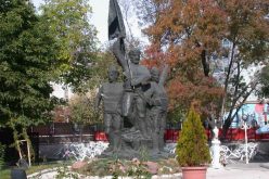
Saraçlar Caddesi. A pedestrianized shopping street with pleasant cafés on sides. The old shop buildings on this street has a distinctively neoclassical architecture. Old quarter. Locally named Kaleiçi, i.e. “walled city”, this is the oldest part of the city although the city walls and gates have vanished a long time ago. Built in a grid plan after it suffered from a big fire in late 19th century, the main artery of this part is Maarif Caddesi, which lies two blocks west of Saraçlar Caddesi. Along the side streets and Maarif itself line a number of eloborate wooden houses, the walls of which are with highly delicate handwork, though some are derelict. At one end of the street is the Jewish Synagogue, the biggest one in Turkey and the whole Balkans, but is slowly decaying now. Almost all of its wooden sections (roof, windows) has collapsed in one way or the other after it suffered from a storm in 1997, but some of its stone walls (especially the front façade) are sound enough to show its former grandeur. Entry is sensibly forbidden. In one of the side alleys of Kaleiçi lie a small stone church, used to be where Catholic congregation of the city held masses, though a part of a local primary school (Istiklal Ilköğretim Okulu) nowadays. Numerous small Ottoman mosques are also scattered around Kaleiçi and elsewhere in downtown. Şükrü Pasha Memorial and Balkan Wars Museum (Şükrü Paşa Anıtı ve Balkan Savaşları Müzesi), (just next to city cemetery, on the highest hill of the city, where that large flag is located). This is a monument dedicated to Rüştü Pasha, the commander of the defending forces of the city during the Balkan Wars. Next to it is a small museum with various weapons (such as a small cannon) used during the war. While the place is slightly away from the downtown and is off the usual trail between the main sights, it occupies the highest hill in the city and offers a large overlooking view of the city and the forests surrounding the rivers behind. Muradiye Mosque (Muradiye Camii), (north of downtown, close to the bridge of Sarayiçi). Northwest Across the Tunca from downtown, in the northwestern outskirts of the city lie Sarayiçi, literally “inside the palace” and Yeni imaret. Both are linked to city centre by their respective medieval bridges. Most of the monuments around this section of the city were actually located in city’s suburbs, however the depopulation of the city resulted much of them now lying in the middle of open fields. Sarayiçi. Upon crossing a long bridge over the Tunca, you will arrive on an island surrounded by two branches of the Tunca (though not immediately recognizable as such while you are actually on it). A modern stadium in which annual wrestling competitions take place, surrounded by some statues of champions of past years will welcome you to this island. Just next to it is the Justice Tower (Adalet Kasrı), a sturdy square tower and the sole completely intact remnant of former imperial palace of Ottomans here. Next to the Tower, a smaller bridge on the narrower branch of the river surrounded by some centuries-old ash trees will take you back to the “mainland”. Here at your right, about 100 metres away, is the monument to the soldiers fallen at the Siege of Edirne in 1913 (Monument to the Martyrs of Balkan War/Balkan Savaşı Şehitliği). The monument itself, which is a recent construction with an older one hidden behind the bushes nearby, is nothing very interesting, typical of many such Turkish monuments built to commemorate World War I and previous battles in, say, Gallipoli. However the site is actually mass grave of an estimated 30,000 soldiers, so appropriate respect should be shown. Further away from the river is the ruins of a number of buildings of the former palace scattered around the fields, which had the unfortunate service as an arsenal during the siege of 1913, and had been blown up in order not to fall in hands of Bulgarians, the opposite side of the battle. Although the place had lost the distinction of being a capital in 15th century, it was still the favourite summer retreat of Ottoman dynasty, featuring numerous hunting manors on the edges of the actual palace. Ruins are now undergoing a slow restoration (or perhaps reconstruction), with the imperial kitchen has returned to its pre-1913 appearance recently. An illustration in front of the gate of the palace building—the only part of the building that escaped the blast—may help you envisage what the palace looked like. South of Sarayiçi is the neighbourhood of Yeni imaret, which, like Sarayiçi, is connected to the downtown by two bridges with an island on the Tunca in between and is where the Medical Museum is located. Medical Museum (Sağlık Müzesi), which was awarded “European Museum of the Year” in early 2000s, was essentially a mental institution used during Ottoman times, part of Beyazıt Complex (Beyazıt Külliyesi). It was notable for its “progressive”/”alternative” approach towards its patients. Instead of locking them into cells with shackles, which was widespread during that time, methods such as meditative music or flower gardens were tried in this institution.
Today, many Ottoman miniatures from medical school books and elsewhere and models of patients are among the displayed.
Adress: Beyazıt Külliyesi, Yeni imaret (close to the banks of Tunca),
Tel :+90 284 224-09-22 ([email protected], fax: +90 284 224-65-00).
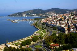
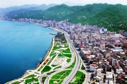
South of Yeni imaret, due west of city centre is Gazi Mihal Bridge (Gazi Mihal Köprüsü), a long arch bridge built during Byzantine period and then repaired in 1420 that spans the Tunca and lies on the main highway to Kapıkule border post from city centre, and the adjacent Gazi Mihal Mosque (Gazi Mihal Camii), built by Gazi Mihal Pasha, an Ottoman commander of Bulgarian origin. These are better accessible from city centre rather than from Yeni imaret, though a stroll along the dykes along the Tunca will bring you here too. Southwest Southwest of downtown is the quarter of Karaağaç (pronounced kaa raa aa ach), the only Turkish territory west of Meric River, which forms most of Turkish-Greek land border. Two Ottoman bridges connect Karaağaç to downtown, which are well worth a look—pick these if you don’t have time to check out any other bridge around the city. The first and shorter one, just southwest of the edge of old quarter (Kaleiçi) and actually quite close to the Synagogue at the end of Maarif Caddesi, spans the Tunca. About 250 mt further, you’ll arrive at the second one, which spans the Meric and is gloriously longer than the first one, as the riverbed is gloriously larger, not much unlike that of Danube. Right at the midpoint of the bridge, there is a lookout in typical Ottoman style. A two-and-a-half-kilometre long cobbled road through a lush forest links the Meric Bridge with Karaağaç. On the way, there is an urban forest named Söğütlük , a favourite weekend picnic spot of locals which extends along the bank of river. Karaağaç has an atmosphere more of a town rather than a city neighbourhood, with some charming mansions scattered around its grid plan. At the southwestern end of Karaağaç is the historical building in late Ottoman style of the Presidency of Trakya University (Trakya Üniversitesi Rektörlüğü), placed in a pleasant garden (free admission). The building, which dates back to the final years of 19th century, was originally built as the main train station of the city as the steam locomotive at the backyard still attests, and had that service for years until 1970s when it was abandoned after a new railway straight to the city was laid, due to the increasingly inconvenient operation of former rail tracks crisscrossing Turkish-Greek border as the relations between two nations detoriate. The university took over in 1998. At the side of the building is Lausanne Monument (Lozan Anıtı), a metallic structure of three columns symbolizing Turkey (the longest one symbolizes Asian Turkey, the middle-sized symbolizes Eastern Thrace (European Turkey), while the shortest symbolizes Karaağaç itself, being the only Turkish soil west of Meric River, in other words west of Eastern Thrace) with a lady in the middle holding a sheet of paper, presumably symbolizing Treaty of Lausanne, in which major western powers recognized newly founded Turkish Republic in 1923. Behind the monument, in the shades of a pine woods is an open air sculpture exhibition (free admission) which contains marble statues chipped in situ by sculptors from neighbouring countries. Beaches Edirne has border with the Aegean Sea (Saros Gulf) at the south part of the province and the shores and the beaches have rich tourism potential.
Edirne – Gala Lake Nature Reserve The lake is 10km away from district of Enez, which is in the far southwest corner of Thrace, and near the villages of Karpuzlu and Koyun. The nature reserve covers an area of 2369 hectares, and houses 111 species of birds, many of which are extremely rare and under threat of extinction. The area was specifically set up to protect the wildlife, increase the awareness of conservation and also enable scientific research to take place. The ecosystem of the lake, its salinity, plankton and temperature changes, are also of great scientific interest.